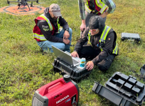
Yes. Medusa sensors are platform-agnostic and designed to work with any survey platform — including drones (UAVs). The MS-350 is the most commonly used Medusa sensor for drone-borne surveys due to its compact form factor and low weight.
For drone integration, the sensor only requires a stable power supply (typically from the drone’s battery system via a power output port). The sensor operates autonomously and logs data with GPS coordinates, which can be monitored in real time via the mDOS interface on a tablet or phone.
Important considerations for drone surveys include:
- Flying altitude: lower altitudes improve spatial resolution but reduce area coverage per flight.
- Flight speed: should be matched to the detector volume and required data density.
- Line spacing: typically 50–100 m for broad surveys, narrower for detailed work.
Medusa’s documentation includes detailed guidelines for drone survey planning and best practices for different applications.